
Embarking on a pilgrimage to the historic shrine of Maa Ashapura at Mata No Madh in the heart of Kutch, Gujarat, requires clear navigation through the vast networks of Western India’s highway corridors. Located in Nakhatrana taluka, roughly 95 kilometers west of Bhuj, this revered temple town draws millions of devotees annually. Navigating the expanding road networks, highway bypasses, and transport corridors using the most efficient Mata No Madh travel routes ensures a smooth, hassle-free journey across the unique terrain of the Kutch peninsula.
As the premier digital informational portal dedicated to pilgrims and travelers worldwide, matanamadh.in presents this definitive 2026 travel route manual. Whether you are driving a personal car from major metros like Ahmedabad, Rajkot, Surat, or Vadodara, utilizing public transit via state bus networks, or transferring from railway terminals at Bhuj and Gandhidham, this comprehensive guide provides precise highway alignments, distance breakdowns, road conditions, and essential pit stops.
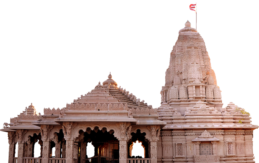
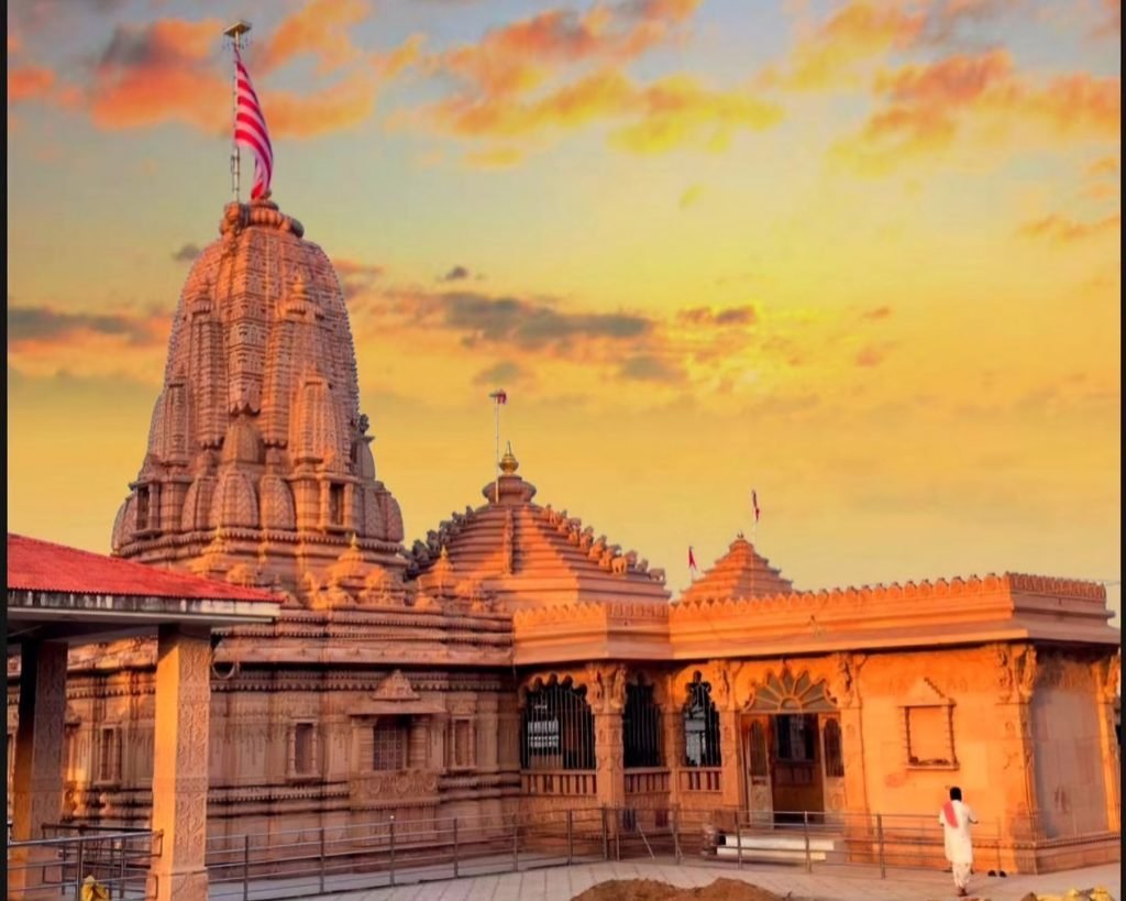
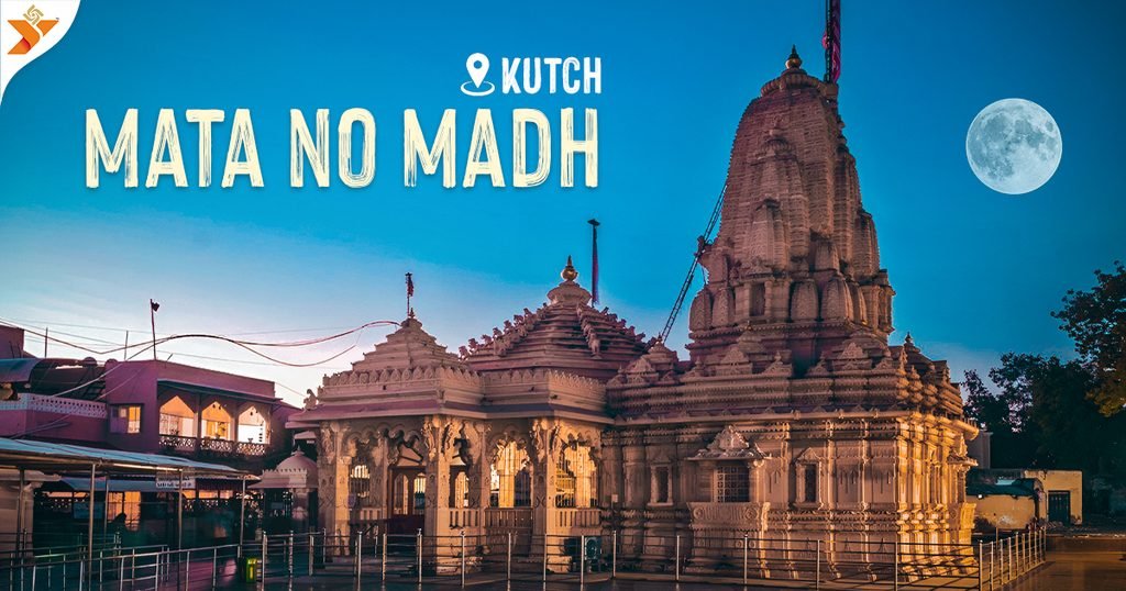
Table of Contents
Section 1: Geographical Overview & The Primary Kutch Transport Spine
The holy village of matanomadh sits in western Kutch, flanked by rugged hills and vast salt plains. Accessing this remote sanctuary requires navigating through specific gateway towns that connect mainland Gujarat to the Kutch district.
The Gateway Bottlenecks: Samakhiyali & Malia
All vehicular traffic entering Kutch from eastern, central, and southern Gujarat must pass through one of two primary entry bridges across the Little Rann region:
- Samakhiyali Gateway: The primary northern entry point carrying National Highway 27 traffic.
- Malia Gateway: The southern coastal link carrying traffic originating from Morbi, Rajkot, and Saurashtra.
Once past these gateway points, traffic moves along high-capacity expressways toward Bhuj, which serves as the central aggregation node for all transport proceeding further west to mata na madh.
| Key Transit Hub | Distance to Mata No Madh | Road Network Classification | Operational Role |
| Samakhiyali Junction | ~290 km | NH 27 Four-Lane Expressway | Primary entrance from Mainland Gujarat |
| Gandhidham City | ~230 km | NH 41 / SH Interlink | Major rail transfer & commercial node |
| Bhuj Central Node | ~95 km | State Highway 42 | Primary district hub for western transport |
| Nakhatrana Town | ~47 km | State Highway 42 | Key intermediate refueling & dining town |
Section 2: Main Arterial Route: Ahmedabad to Mata No Madh
Travelers departing from Ahmedabad—the major transit gateway for interstate tourists and flight arrivals—have two main highway options to reach matanamadh.
Route Option 1: The Express Corridor via Viramgam & Halvad (NH 27)
This is the fastest and most direct driving route for private light vehicles, express buses, and taxi services.
- Detailed Waypoint Trajectory: Ahmedabad $\rightarrow$ Sanand $\rightarrow$ Viramgam $\rightarrow$ Dhrangadhra $\rightarrow$ Halvad $\rightarrow$ Samakhiyali $\rightarrow$ Bhachau $\rightarrow$ Bhuj $\rightarrow$ Nakhatrana $\rightarrow$ mata no madh.
- Total Driving Distance: ~425 km.
- Average Travel Time: 7.5 to 8.5 hours.
- Road Surface Profile: Fully paved 4-lane divided highway from Ahmedabad to Bhuj; well-maintained 2-lane wide state highway from Bhuj to Mata No Madh.
Route Option 2: The Southern Bypass via Limbdi & Morbi
An alternative route preferred by travelers departing from South Ahmedabad or those seeking to avoid heavy commercial transport corridors around Halvad during peak hours.
- Detailed Waypoint Trajectory: Ahmedabad $\rightarrow$ Bagodara $\rightarrow$ Limbdi $\rightarrow$ Sayla $\rightarrow$ Morbi $\rightarrow$ Malia $\rightarrow$ Samakhiyali $\rightarrow$ Anjar $\rightarrow$ Bhuj $\rightarrow$ matanomadh.
- Total Driving Distance: ~460 km.
- Average Travel Time: 8.5 to 9.5 hours.
- Key Feature: Excellent access to roadside dining facilities and multi-lane toll expressways across the Morbi-Malia belt.
Section 3: Regional Access Corridors: Rajkot, Surat, Vadodara, & Saurashtra
Devotees traveling from Saurashtra and South Gujarat can utilize dedicated regional feeder highways that connect seamlessly with the Kutch transport grid.
Regional Route Matrix to Mata No Madh
| Departure Point | Primary Highway Alignment | Distance (Approx.) | Key Pit Stops & Bypasses |
| Rajkot | Morbi Road $\rightarrow$ Malia $\rightarrow$ Samakhiyali $\rightarrow$ Bhuj $\rightarrow$ Mata No Madh | ~310 km | Morbi Chokdi, Malia Toll, Anjar Bypass |
| Surat | NH 48 / NE 1 $\rightarrow$ Ahmedabad Bypass $\rightarrow$ Viramgam $\rightarrow$ Bhuj | ~680 km | Vadodara Bypass, Samakhiyali, Nakhatrana |
| Vadodara | National Expressway 1 $\rightarrow$ Viramgam Corridor $\rightarrow$ Bhuj | ~530 km | Anand Bypass, Halvad, Bhachau |
| Jamnagar | Dhrol $\rightarrow$ Morbi $\rightarrow$ Malia Bypass $\rightarrow$ Bhuj $\rightarrow$ Mata No Madh | ~325 km | Falla, Samakhiyali, Nakhatrana |
For travelers choosing state bus transport along these corridors, direct schedules and online seat reservations can be booked through the GSRTC Official Web Portal.
Section 4: The Essential Western Stretch: Bhuj to Mata No Madh (SH 42)
The 95-kilometer drive along State Highway 42 from Bhuj to mata na madh is the final, most iconic leg of the journey. The highway winds through the distinct landscape of Nakhatrana taluka.
Step-by-Step Waypoint Breakdown (SH 42 Spine)
- Bhuj Departure Gate (0 km): Exit Bhuj via Madhapar Chokdi or the Western Ring Road onto State Highway 42.
- Kukma & Desalpar Belt (10 – 35 km): Smooth two-lane driving through agricultural country with frequent village intersections.
- Nakhatrana Town Hub (47 km): The mid-point of the Western stretch. Features fuel stations, mechanical workshops, local restaurants, and medical centers.
- Virani Moti & Manjal Junction (60 – 78 km): Undulating countryside road with mild curves. Drivers should watch for speed control zones near village approaches.
- Mata No Madh Outer Gateway (90 – 95 km): Approach roads widen into multi-lane entry corridors leading to outer ring parking bays and the central temple terminal.
Section 5: Road Infrastructure 2026: Highway Conditions, Toll Plazas & Fuel Hubs
Road infrastructure connecting major Gujarat hubs to matanamadh is designed for modern automobile speeds, though drivers should note active toll plazas and fuel availability.
Highway Toll & Quality Overview
| Highway Segment | Road Type & Condition | Active Toll Plazas | FASTag Supported |
| Ahmedabad – Viramgam – Halvad | Four-Lane Divided (Good) | Viramgam Toll Plaza | Yes |
| Halvad – Samakhiyali | Four-Lane Divided (Moderate Truck Traffic) | Halvad & Samakhiyali Plazas | Yes |
| Samakhiyali – Bhuj (NH 27) | Four-Lane Expressway (Excellent) | Gandhidham / Anjar Bypasses | Yes |
| Bhuj – Nakhatrana – Mata No Madh | Two-Lane State Highway with Shoulders (Good) | Toll-Free Corridor | N/A |
Fuel & Electric Vehicle Charging Availability
- 24/7 Petrol & Diesel: Plentiful supply along National Highway 27 and State Highway 42, with major fuel stations concentrated at Samakhiyali, Bhuj, and Nakhatrana.
- CNG Stations: Available at key urban nodes including Ahmedabad Bypass, Viramgam, Halvad, Samakhiyali, Gandhidham, Bhuj, and Nakhatrana.
- EV Charging Stations: EV fast-charging hubs are operational along NH 27 at Samakhiyali, Gandhidham, and central Bhuj. EV drivers should charge fully at Bhuj before driving the final 95 km to mata no madh.
Section 6: Pedestrian Safety Corridors & Padayatra Highway Networks
The walking pilgrimage (Padayatra) to mata na madh during the festival season is one of the largest religious foot marches in Western India. To manage safety across highway stretches, local authorities and voluntary organizations create dedicated pedestrian corridors along the main roads.
Pedestrian Safety Infrastructure Along Primary Corridors
- Segregated Walking Lanes: Reflective barricades and temporary rope barriers line State Highway 42 from Bhuj to matanomadh, separating heavy vehicular traffic from walking pilgrims.
- Night Visibility Initiatives: Volunteers distribute reflective armbands and fluorescent stickers to Padayatris at highway entry checkpoints near Madhapar and Nakhatrana.
- Medical & Refreshment Rest Camps: Over 150 community-funded Seva Tents operate along the highway, offering free meals, hydration, blister care, and resting spaces every 3 to 5 kilometers.
Section 7: Scenic Countryside Routes, By-passes & Congestion Evasion Alternatives
During peak travel periods, high vehicle density along the main Bhuj–Nakhatrana State Highway 42 corridor can lead to localized slowdowns. Drivers seeking alternative, low-traffic Mata No Madh travel routes can utilize rural feeder networks.
Alternative Bypass Route Matrix
| Route Name | Waypoint Path | Total Distance | Road Profile & Suited Vehicle Type |
| Northern Coastal Bypass | Bhuj $\rightarrow$ Khavda Road Junction $\rightarrow$ Vighakot Link $\rightarrow$ Lakhpat Highway $\rightarrow$ Mata No Madh | ~115 km | Scenic 2-lane road; suitable for SUVs and light vehicles seeking to bypass Nakhatrana town traffic. |
| Southern Anjar-Mandvi Feeder | Gandhidham $\rightarrow$ Anjar $\rightarrow$ Mundra $\rightarrow$ Mandvi $\rightarrow$ Tera $\rightarrow$ Mata No Madh | ~245 km | Smooth coastal highway corridor; bypasses central Bhuj gridlock completely. |
| Nakhatrana Outer Rural Loop | Desalpar $\rightarrow$ Manjal $\rightarrow$ Netra $\rightarrow$ Tera $\rightarrow$ Matanamadh Outer Bay | ~102 km | Paved rural road; bypasses Nakhatrana market areas during festival peak hours. |
Section 8: Final Approach Navigation, Town Entry Gates & Parking Bay Maps
To preserve pedestrian safety near the primary temple court, traffic police enforce strict outer parking guidelines at mata no madh.
| Transit Route / Node | Details & Path |
| Incoming Point | Incoming Private Vehicles / Buses |
| Primary Inspection | Outer Ring Road Checkpoint |
| Private Transport Route | Private Vehicle Bay (1.5 – 2 km Outer) $\rightarrow$ Pedestrian Plaza |
| Public Transit Route | GSRTC Transit Terminal (Dedicated Inner Corridor) $\rightarrow$ Free Local Shuttle $\rightarrow$ Pedestrian Plaza |
Parking Bay Classification & Vehicle Access Levels
- Outer Bay A (Private Light Vehicles & SUVs): Located 1.5 km before the main village ring road. Fully lit with high-mast lighting and equipped with mobile toilet facilities.
- Outer Bay B (Heavy Tour Buses & Private Charters): Located 2.5 km away near the Nakhatrana approach junction. Connected to the main temple gate via continuous walking tracks and local shuttle connections.
- Inner Reserved Bay (Emergency & Administrative Vehicles): Accessible strictly with official passes issued by the District Collectorate or the Shri Mata No Madh Jagir Trust.
Section 9: Emergency Assistance, Mechanical Service Centers & Highway Medical Hubs
Traversing rural Kutch requires quick access to emergency services, mechanical support, and medical aid along the highway.
Emergency Contact & Support Directory
| Service Type | Service Provider / Unit | Contact Details / Location |
| Highway Ambulance Service | Gujarat 108 Emergency Service | Dial 108 (Stationed at Bhuj, Nakhatrana, and Mata No Madh) |
| Police Control Room | Kutch West District Police | Dial 100 / +91 2832 250100 |
| Roadside Breakdown Assistance | GSRTC Mobile Repair Unit | Stationed at Nakhatrana ST Depot & Bhuj Central Terminal |
| Central Medical Center | Community Health Centre (CHC) | Nakhatrana Main Road & Temporary Medical Tents at Mata No Madh |
Section 10: Comprehensive Travel Protocols, Distance Matrix & FAQs
Driving Distance Quick Reference Table
| Origin Hub | Route Alignment | Total Distance (km) | Estimated Driving Time |
| Bhuj | SH 42 (Direct) | 95 km | 1.5 to 2 hours |
| Gandhidham | NH 41 via Bhuj | 230 km | 4 to 4.5 hours |
| Ahmedabad | NH 27 via Viramgam & Halvad | 425 km | 7.5 to 8.5 hours |
| Rajkot | SH via Morbi & Samakhiyali | 310 km | 6 to 6.5 hours |
| Surat | NH 48 / NH 27 via Ahmedabad Bypass | 680 km | 12 to 13 hours |
Frequently Asked Questions (FAQs)
Q1: What is the best time of day to drive from Bhuj to Mata No Madh to avoid heavy traffic?
A: Early morning hours (05:00 AM to 08:00 AM) or late afternoon offer smooth driving conditions with minimal highway congestion near intermediate towns.
Q2: Are private cars allowed directly near the Mata No Madh temple entrance?
A: No. Private cars must park at designated outer parking bays located 1.5 to 2 km from the temple precinct. Shuttle services and dedicated walking paths connect the parking bays to the main shrine.
Q3: Is the road from Bhuj to Mata No Madh fully paved and safe for night driving?
A: Yes, State Highway 42 is a wide, fully paved two-lane state highway with marked shoulders. Police patrol vans operate along the route round-the-clock during festival periods to ensure safety.